Geolocate

Montcélèbre topographic map

Click on the map to display elevation.

About this map
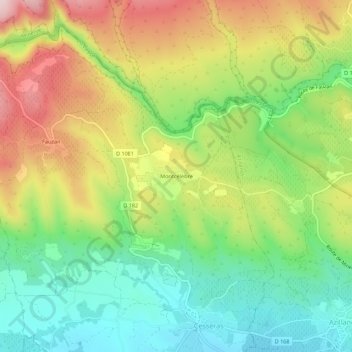
Name: Montcélèbre topographic map, elevation, terrain.

Location: Montcélèbre, Cesseras, Béziers, Hérault, Occitanie, France métropolitaine, 34210, France (43.32119 2.69166 43.36119 2.73166)

Average elevation: 218 m

Minimum elevation: 74 m

Maximum elevation: 417 m

Other topographic maps

Click on a map to view its topography, its elevation and its terrain.

34210

France > Occitanie > Hérault > Cesseras

Average elevation: 327 m

Gear up for your next adventure:

🧢Outdoor Visor - Breathable visor for sunny hikes
🧥Packable Rain Jacket - Breathable waterproof layer for unpredictable weather
🔥Camping Stove - Portable stoves to cook outdoors with ease
🥾Waterproof Hiking Boots - Boots keeping your feet dry in wet conditions
🥾Hiking Boots - Sturdy boots providing ankle support and traction on rugged trails

As an Amazon Associate, this site earns from qualifying purchases at no extra cost to you.