Geolocate

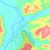
Monterey topographic map

Click on the map to display elevation.

About this map

Name: Monterey topographic map, elevation, terrain.

Location: Monterey, Owen County, Kentucky, United States (38.41865 -84.87955 38.42839 -84.86639)

Average elevation: 185 m

Minimum elevation: 132 m

Maximum elevation: 270 m

Other topographic maps

Click on a map to view its topography, its elevation and its terrain.

Breck

United States > Kentucky > Owen County

Average elevation: 247 m

Perry Park

United States > Kentucky > Owen County

Average elevation: 173 m

New Liberty

United States > Kentucky > Owen County

Average elevation: 253 m

New Liberty

United States > Kentucky > Owen County

Average elevation: 253 m

Gear up for your next adventure:

🎒Hiking Daypack - Lightweight and durable backpacks for day trips and excursions
🥾Lightweight Hiking Boots - Boots for comfort and mobility on long hikes
🧴Sunscreen SPF - Broad-spectrum sunscreen for outdoor activities
🥾Waterproof Hiking Shoes - Durable shoes for wet and rugged trails
🔋Solar Power Bank - Keep your GPS and devices charged during long outdoor trips

As an Amazon Associate, this site earns from qualifying purchases at no extra cost to you.