Geolocate

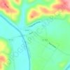
Breck topographic map

Click on the map to display elevation.

About this map

Name: Breck topographic map, elevation, terrain.

Location: Breck, Owen County, Kentucky, United States (38.47590 -84.75550 38.51590 -84.71550)

Average elevation: 247 m

Minimum elevation: 212 m

Maximum elevation: 280 m

Other topographic maps

Click on a map to view its topography, its elevation and its terrain.

Owenton

United States > Kentucky > Owen County

Average elevation: 274 m

Monterey

United States > Kentucky > Owen County

Average elevation: 185 m

Gratz

United States > Kentucky > Owen County

Average elevation: 173 m

Owenton

United States > Kentucky > Owen County

Average elevation: 274 m

Gear up for your next adventure:

🛶Kayak Dry Bag - Waterproof storage for kayaking adventures
🏕️Camping Hammock - Integrated protection for sleeping between trees
🦶Hiking Shoe Insoles - Added support for high arches and long days on feet
🥾Lightweight Hiking Shoes - Comfortable shoes for day hikes
❄️Traction Ice Cleats - Slip-on spikes for icy trails and winter hiking

As an Amazon Associate, this site earns from qualifying purchases at no extra cost to you.