
June Lake topographic map
Click on the map to display elevation.
June Lake
June Lake is an unincorporated community and census-designated place (CDP) in Mono County, California, United States. It is located against the southern rim of the Mono Basin, 12.5 miles (20 km) south of Lee Vining, at an elevation of 7,654 feet (2,333 m).
About this map
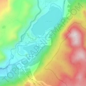
Name: June Lake topographic map, elevation, terrain.
Location: June Lake, Mono County, California, 93529, United States (37.75853 -119.09625 37.79853 -119.05625)
Average elevation: 2,548 m
Minimum elevation: 2,271 m
Maximum elevation: 2,973 m
Other topographic maps
Click on a map to view its topography, its elevation and its terrain.
Owens River Headwaters Wilderness
United States > California > Mono County > Mammoth Lakes
Average elevation: 2,683 m