Geolocate

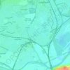
Stanley Common topographic map

Click on the map to display elevation.

About this map

Name: Stanley Common topographic map, elevation, terrain.

Location: Stanley Common, Erewash, Derbyshire, England, DE7 6FX, United Kingdom (52.95667 -1.40440 52.99667 -1.36440)

Average elevation: 107 m

Minimum elevation: 62 m

Maximum elevation: 147 m

Other topographic maps

Click on a map to view its topography, its elevation and its terrain.

Stanton by Dale

United Kingdom > England > Derbyshire > Erewash

Average elevation: 71 m

Long Eaton

United Kingdom > England > Derbyshire > Erewash

Average elevation: 35 m

Little Eaton

United Kingdom > England > Derbyshire > Erewash

Average elevation: 82 m

Sandiacre

United Kingdom > England > Derbyshire > Erewash

Average elevation: 57 m

Breaston

United Kingdom > England > Derbyshire > Erewash

Average elevation: 40 m

Risley

United Kingdom > England > Derbyshire > Erewash

Average elevation: 79 m

Derby Canal

United Kingdom > England > Derbyshire > Erewash > Draycott

Average elevation: 48 m

Morley

United Kingdom > England > Derbyshire > Erewash

Average elevation: 105 m

Long Eaton

United Kingdom > England > Derbyshire > Erewash

Average elevation: 31 m

Dale Abbey

United Kingdom > England > Derbyshire > Erewash

Average elevation: 89 m

Sawley

United Kingdom > England > Derbyshire > Erewash

Average elevation: 32 m

Ilkeston

United Kingdom > England > Derbyshire > Erewash

Average elevation: 72 m

Breadsall

United Kingdom > England > Derbyshire > Erewash

Average elevation: 87 m

River Erewash

United Kingdom > England > Derbyshire > Erewash

The approximate meaning of the name is not in doubt, but there is room for debate about the precise derivation and its connotations. Brewer gives the commonly accepted explanation that it comes from the Old English words irre ("wandering") and wisce ("wet meadow"). This is accepted by Kenneth Cameron, a…

Average elevation: 87 m

Ilkeston

United Kingdom > England > Derbyshire > Erewash

Average elevation: 72 m

Sawley

United Kingdom > England > Derbyshire > Erewash

Average elevation: 32 m

Long Eaton

United Kingdom > England > Derbyshire > Erewash

Average elevation: 35 m

Long Eaton

United Kingdom > England > Derbyshire > Erewash

Average elevation: 35 m

Long Eaton

United Kingdom > England > Derbyshire > Erewash

Average elevation: 35 m

Ilkeston

United Kingdom > England > Derbyshire > Erewash

Average elevation: 72 m

Gear up for your next adventure:

🧥Softshell Hiking Jacket - The perfect balance of wind protection and breathability
🥘Camping Cookware Set - Compact nesting pots and pans for trail cooking
🥾Waterproof Hiking Boots - Boots keeping your feet dry in wet conditions
🔪Outdoor Multitool - Versatile tool for repairs and food prep in the wild
🛶Kayak Accessories - Essential gear for safe and fun kayaking adventures

As an Amazon Associate, this site earns from qualifying purchases at no extra cost to you.