
Make a donation
Gear up for your next adventure:
As an Amazon Associate, this site earns from qualifying purchases at no extra cost to you.
Kenosha Pass topographic map
Click on the map to display elevation.
Make a donation
Gear up for your next adventure:
As an Amazon Associate, this site earns from qualifying purchases at no extra cost to you.
Kenosha Pass
Kenosha Pass, elevation 10,000 ft (3,000 m), is a high mountain pass located in the Rocky Mountains of central Colorado in the United States.
Make a donation
Gear up for your next adventure:
As an Amazon Associate, this site earns from qualifying purchases at no extra cost to you.
About this map
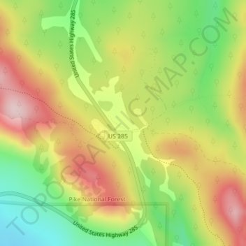
Name: Kenosha Pass topographic map, elevation, terrain.
Location: Kenosha Pass, Park County, Colorado, United States (39.41406 -105.75775 39.41416 -105.75765)
Average elevation: 3,047 m
Minimum elevation: 2,904 m
Maximum elevation: 3,190 m
Make a donation
Gear up for your next adventure:
As an Amazon Associate, this site earns from qualifying purchases at no extra cost to you.
Other topographic maps
Click on a map to view its topography, its elevation and its terrain.