
Make a donation
Gear up for your next adventure:
As an Amazon Associate, this site earns from qualifying purchases at no extra cost to you.
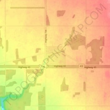
DeBolt topographic map
Click on the map to display elevation.
Make a donation
Gear up for your next adventure:
As an Amazon Associate, this site earns from qualifying purchases at no extra cost to you.
DeBolt
DeBolt is located in Peace Country, 58 km (36 mi) east from Grande Prairie and 54 km (34 mi) west of Valleyview along Highway 43. It lies in the Smoky River valley, at an elevation of 640 m (2,100 ft).
Make a donation
Gear up for your next adventure:
As an Amazon Associate, this site earns from qualifying purchases at no extra cost to you.
About this map
Name: DeBolt topographic map, elevation, terrain.
Average elevation: 644 m
Minimum elevation: 599 m
Maximum elevation: 664 m
Municipal District of Greenview trails, hiking, mountain biking, running and outdoor activities
Make a donation
Gear up for your next adventure:
As an Amazon Associate, this site earns from qualifying purchases at no extra cost to you.
Other topographic maps
Click on a map to view its topography, its elevation and its terrain.