
Edmundston topographic map
Click on the map to display elevation.
Edmundston
Edmundston has a downhill skiing facility in the city at Mont Farlagne. This facility has 3 lifts, a t-bar, a double chair, and a quad chair. It has 14 trails and an elevation of 690 feet. Snowmaking is available. Five trails are lit for night skiing.
About this map
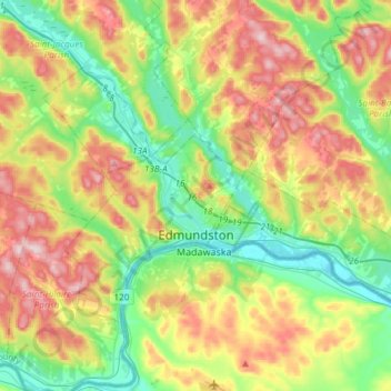
Name: Edmundston topographic map, elevation, terrain.
Average elevation: 256 m
Minimum elevation: 131 m
Maximum elevation: 450 m
New Brunswick trails, hiking, mountain biking, running and outdoor activities