
Happisburgh topographic map
Click on the map to display elevation.
About this map
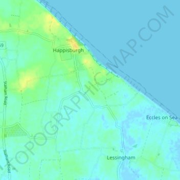
Name: Happisburgh topographic map, elevation, terrain.
Location: Happisburgh, North Norfolk, Norfolk, England, United Kingdom (52.79383 1.50984 52.83460 1.56395)
Average elevation: 4 m
Minimum elevation: -3 m
Maximum elevation: 21 m
Other topographic maps
Click on a map to view its topography, its elevation and its terrain.
Whimpwell Green
United Kingdom > England > Norfolk > North Norfolk > Happisburgh
Average elevation: 4 m