Geolocate

Trevone topographic map

Click on the map to display elevation.

About this map

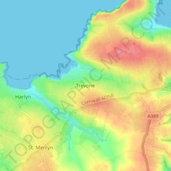
Name: Trevone topographic map, elevation, terrain.

Location: Trevone, Padstow, Cornwall, England, PL28 8QS, United Kingdom (50.52105 -4.99467 50.56105 -4.95467)

Average elevation: 31 m

Minimum elevation: 0 m

Maximum elevation: 75 m

Gear up for your next adventure:

🧶550 Survival Paracord - Versatile utility cord for emergency repairs and rigging
🧥Packable Rain Jacket - Breathable waterproof layer for unpredictable weather
🥾Trail Hiking Boots - Supportive boots for rough trails
🧭Orienteering Kit - Tools for map reading and navigation in the wild
🧤Thermal Hiking Gloves - Grip-enhanced gloves for cold-weather altitude trekking

As an Amazon Associate, this site earns from qualifying purchases at no extra cost to you.