Geolocate

Fangataufa topographic map

Click on the map to display elevation.

About this map
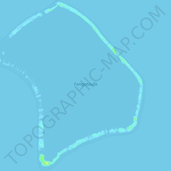
Name: Fangataufa topographic map, elevation, terrain.

Location: Fangataufa, Tureia, Tuamotu-Gambier, French Polynesia, 98784, France (-22.28376 -138.79274 -22.19446 -138.70150)

Average elevation: 0 m

Minimum elevation: -1 m

Maximum elevation: 16 m

Other topographic maps

Click on a map to view its topography, its elevation and its terrain.

Moruroa

France > French Polynesia > Tureia

Average elevation: 0 m

Tematangi

France > French Polynesia > Tureia

Average elevation: 0 m

Tureia

France > French Polynesia > Tureia

Average elevation: 0 m

Vanavana

France > French Polynesia > Tureia

Average elevation: 0 m

Vanavana

France > French Polynesia > Tureia

Average elevation: 0 m

Gear up for your next adventure:

🛶Kayak Dry Bag - Waterproof storage for kayaking adventures
🥾Trail Running Shoes - Lightweight and durable shoes for trail running
🥾All-Terrain Hiking Boots - Versatile boots for varied hiking conditions
🧢Sun Protection Cap - Breathable cap to protect from sun exposure
🔋Solar Power Bank - Keep your GPS and devices charged during long outdoor trips

As an Amazon Associate, this site earns from qualifying purchases at no extra cost to you.