Geolocate

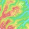
Klake topographic map

Click on the map to display elevation.

About this map

Name: Klake topographic map, elevation, terrain.

Location: Klake, Grad Samobor, Zagreb County, Croatia (45.74690 15.67791 45.76431 15.72466)

Average elevation: 389 m

Minimum elevation: 196 m

Maximum elevation: 729 m

Other topographic maps

Click on a map to view its topography, its elevation and its terrain.
Beder

Croatia > Zagreb County > Grad Samobor

Average elevation: 414 m

Gear up for your next adventure:

🧥Softshell Hiking Jacket - The perfect balance of wind protection and breathability
🥾Hiking Boots - Sturdy boots providing ankle support and traction on rugged trails
🥾Durable Hiking Shoes - Long-lasting shoes for frequent hiking
🧰Survival Kit - Essential gear for emergencies in the wilderness
🔦UV Flashlight - Detect minerals or specific insects in the dark

As an Amazon Associate, this site earns from qualifying purchases at no extra cost to you.