
Specie Mesa topographic map
Interactive map
Click on the map to display elevation.
About this map
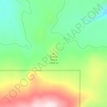
Name: Specie Mesa topographic map, elevation, terrain.
Location: Specie Mesa, San Miguel County, Colorado, United States (37.95633 -108.07512 37.95643 -108.07502)
Average elevation: 2,933 m
Minimum elevation: 2,734 m
Maximum elevation: 3,240 m
Other topographic maps
Click on a map to view its topography, its elevation and its terrain.
Silver Lake
United States > Colorado > San Miguel County
Silver Lake, San Miguel County, Colorado, United States
Average elevation: 3,459 m
Telluride
United States > Colorado > San Miguel County
Telluride, San Miguel County, Colorado, 81435, United States
Average elevation: 3,125 m
Mountain Village
United States > Colorado > San Miguel County
Mountain Village, San Miguel County, Colorado, United States
Average elevation: 2,917 m
Telluride
United States > Colorado > San Miguel County > Telluride
Telluride, San Miguel County, Colorado, 8145, United States
Average elevation: 3,246 m
Norwood
United States > Colorado > San Miguel County > Norwood
Norwood, San Miguel County, Colorado, 81325, United States
Average elevation: 2,148 m
Placerville
United States > Colorado > San Miguel County > Placerville
Placerville, San Miguel County, Colorado, 81430, United States
Average elevation: 2,460 m