Geolocate

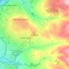
Dunnockshaw topographic map

Click on the map to display elevation.

About this map

Name: Dunnockshaw topographic map, elevation, terrain.

Location: Dunnockshaw, Burnley, Lancashire, England, United Kingdom (53.74225 -2.29527 53.75709 -2.25652)

Average elevation: 314 m

Minimum elevation: 233 m

Maximum elevation: 400 m

Other topographic maps

Click on a map to view its topography, its elevation and its terrain.
Haggate

United Kingdom > England > Lancashire > Burnley

Average elevation: 220 m

Hameldon Hill

United Kingdom > England > Lancashire > Burnley

Average elevation: 309 m

Walk Mill

United Kingdom > England > Lancashire > Burnley

Average elevation: 227 m

Worsthorne

United Kingdom > England > Lancashire > Burnley

Average elevation: 217 m

Gear up for your next adventure:

🧴First Aid Kit - Essential first aid supplies for outdoor emergencies
🎒Fully Waterproof Backpack - Total protection for photography gear and electronics
🦶Anti-Blister Balm - Prevents friction and hotspots during long ascents
🧥Waterproof Pants - Keep dry during rainy hiking conditions
🧴Waterproofing Spray - Restore the DWR coating on jackets and tents

As an Amazon Associate, this site earns from qualifying purchases at no extra cost to you.