Geolocate

Whitney topographic map

Click on the map to display elevation.

About this map

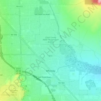
Name: Whitney topographic map, elevation, terrain.

Location: Whitney, Clark County, Nevada, United States (36.07457 -115.06436 36.13578 -115.01146)

Average elevation: 520 m

Minimum elevation: 480 m

Maximum elevation: 603 m

Gear up for your next adventure:

💡LED Headlamp - Hands-free illumination for night hiking and camping
🔦LED Headlamp - Hands-free lighting for early morning starts or late finishes
🧢Sun Hat - Wide-brim hat for sun protection
💧Filtered Water Bottle - Safe drinking water on the go
🔦LED Flashlight - Powerful and long-lasting flashlight for camping and emergencies

As an Amazon Associate, this site earns from qualifying purchases at no extra cost to you.