
Jerez de los Caballeros topographic map
Interactive map
Click on the map to display elevation.
About this map
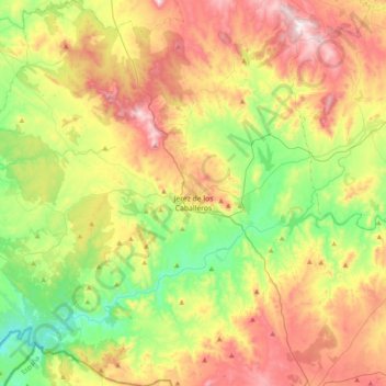
Name: Jerez de los Caballeros topographic map, elevation, terrain.
Average elevation: 446 m
Minimum elevation: 180 m
Maximum elevation: 811 m
Other topographic maps
Click on a map to view its topography, its elevation and its terrain.
Salvaleón
España > Extremadura > Sierra Suroeste
Salvaleón, Sierra Suroeste, Badajoz, Extremadura, España
Average elevation: 531 m
Oliva de la Frontera
España > Extremadura > Sierra Suroeste
Oliva de la Frontera, Sierra Suroeste, Badajoz, Extremadura, España
Average elevation: 334 m