
Harricott topographic map
Click on the map to display elevation.
About this map
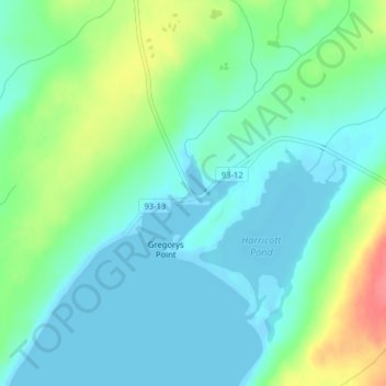
Name: Harricott topographic map, elevation, terrain.
Location: Harricott, Newfoundland, Newfoundland and Labrador, Canada (47.16437 -53.54594 47.18437 -53.52594)
Average elevation: 19 m
Minimum elevation: -7 m
Maximum elevation: 69 m
Newfoundland and Labrador trails, hiking, mountain biking, running and outdoor activities
Other topographic maps
Click on a map to view its topography, its elevation and its terrain.
Clarenville
Canada > Newfoundland and Labrador
The Clarenville area has many of the physical features characteristic of the East Coast of Newfoundland and has a marine climate. It lies along the coastal slopes which rise from the Atlantic Ocean towards the interior central plateau of the island. The dominating physical feature is a ridge of broken peaks…
Average elevation: 102 m