
East Main Post topographic map
Click on the map to display elevation.
About this map
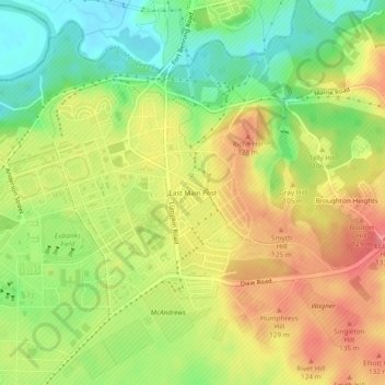
Name: East Main Post topographic map, elevation, terrain.
Average elevation: 100 m
Minimum elevation: 57 m
Maximum elevation: 143 m
Other topographic maps
Click on a map to view its topography, its elevation and its terrain.
Dykes Pond
United States > Georgia > Chattahoochee County > Chattahoochee County
Average elevation: 124 m