Geolocate

Gustavsfors topographic map

Click on the map to display elevation.

About this map

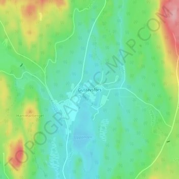
Name: Gustavsfors topographic map, elevation, terrain.

Location: Gustavsfors, Hagfors kommun, Värmland County, 683 91, Sweden (60.13502 13.78550 60.17502 13.82550)

Average elevation: 220 m

Minimum elevation: 180 m

Maximum elevation: 318 m

Other topographic maps

Click on a map to view its topography, its elevation and its terrain.

Sunne kommun

Sweden > Värmland County

Average elevation: 194 m

Hammarö kommun

Sweden > Värmland County

Average elevation: 45 m

Hammarö kommun

Sweden > Värmland County

Average elevation: 45 m

Hagfors kommun

Sweden > Värmland County

Average elevation: 257 m

Kils kommun

Sweden > Värmland County

Average elevation: 104 m

Torsby kommun

Sweden > Värmland County

Average elevation: 356 m

Pottern

Sweden > Värmland County

Average elevation: 145 m

Säffle kommun

Sweden > Värmland County

Average elevation: 89 m

Karlstads kommun

Sweden > Värmland County

Average elevation: 109 m

Filipstads kommun

Sweden > Värmland County

Average elevation: 241 m

Storfors kommun

Sweden > Värmland County

Average elevation: 158 m

Gear up for your next adventure:

🔦LED Headtorch - Bright and durable light for night activities
🦶Anti-Blister Balm - Prevents friction and hotspots during long ascents
🧢Hiking Sun Hat - Wide-brimmed protection for exposed mountain ridges
🧤Rechargeable Heated Gloves - Extreme warmth for Canadian winter expeditions
🥾Trail Running Boots - Durable shoes designed for trail running

As an Amazon Associate, this site earns from qualifying purchases at no extra cost to you.