Geolocate

Edworth topographic map

Click on the map to display elevation.

About this map

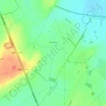
Name: Edworth topographic map, elevation, terrain.

Location: Edworth, Central Bedfordshire, England, United Kingdom (52.03673 -0.23408 52.06691 -0.19501)

Average elevation: 48 m

Minimum elevation: 29 m

Maximum elevation: 79 m

Gear up for your next adventure:

Lightweight Backpacking Tent - Compact tent for efficient hiking trips
💧Collapsible Water Bottle - Space-saving water bottle for outdoor activities
🥾Hiking Leggings - Comfortable leggings for outdoor activities
Camping Groundsheet - Protect your tent from moisture and dirt
🧦Outdoor Socks - Durable socks designed for hiking and outdoor sports

As an Amazon Associate, this site earns from qualifying purchases at no extra cost to you.