Geolocate

Goodman topographic map

Click on the map to display elevation.

About this map

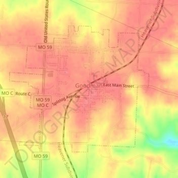
Name: Goodman topographic map, elevation, terrain.

Location: Goodman, McDonald County, Missouri, United States (36.72921 -94.42348 36.74837 -94.39704)

Average elevation: 372 m

Minimum elevation: 324 m

Maximum elevation: 386 m

Other topographic maps

Click on a map to view its topography, its elevation and its terrain.

Powell

United States > Missouri > McDonald County

Average elevation: 341 m

Gear up for your next adventure:

Lightweight Backpacking Tent - Compact tent for efficient hiking trips
🥾Approach Boots - Comfortable boots for hiking and climbing approaches
🔭Outdoor Binoculars - Lightweight binoculars for birdwatching and hiking
🕶️Polarized Sunglasses - Protect your eyes with durable polarized lenses
🧦Merino Wool Socks - Moisture-wicking comfort for long-distance hiking

As an Amazon Associate, this site earns from qualifying purchases at no extra cost to you.