Geolocate

Clive topographic map

Click on the map to display elevation.

About this map
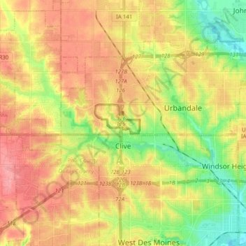
Name: Clive topographic map, elevation, terrain.

Location: Clive, Polk County, Iowa, 50325, United States (41.59642 -93.87222 41.64379 -93.71810)

Average elevation: 287 m

Minimum elevation: 242 m

Maximum elevation: 326 m

Other topographic maps

Click on a map to view its topography, its elevation and its terrain.

Saylorville

United States > Iowa > Polk County

Average elevation: 266 m

Gear up for your next adventure:

🔭Outdoor Binoculars - Lightweight binoculars for birdwatching and hiking
🛌Insulated Sleeping Pad - Critical thermal barrier between you and the cold ground
🧭GPS Handheld Device - Reliable GPS navigation for outdoor adventures
🥾Approach Boots - Comfortable boots for hiking and climbing approaches
👖Convertible Hiking Pants - Zip-off legs to adapt to changing weather conditions

As an Amazon Associate, this site earns from qualifying purchases at no extra cost to you.