Geolocate

Shadoxhurst topographic map

Click on the map to display elevation.

About this map

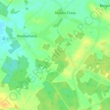
Name: Shadoxhurst topographic map, elevation, terrain.

Location: Shadoxhurst, Ashford, Kent, England, United Kingdom (51.08325 0.79816 51.11918 0.85912)

Average elevation: 43 m

Minimum elevation: 31 m

Maximum elevation: 59 m

Gear up for your next adventure:

🧤Rechargeable Heated Gloves - Extreme warmth for Canadian winter expeditions
💧Collapsible Water Bottle - Space-saving water bottle for outdoor activities
🧥Waterproof Pants - Keep dry during rainy hiking conditions
🪜Heavy Duty Carabiners - Multi-use clips for securing gear to your backpack
🧢Sun Protection Cap - Breathable cap to protect from sun exposure

As an Amazon Associate, this site earns from qualifying purchases at no extra cost to you.