
Thank you for supporting this site ❤️
Make a donation
Make a donation
Gear up for your next adventure:
As an Amazon Associate, this site earns from qualifying purchases at no extra cost to you.
Heamoor topographic map
Click on the map to display elevation.
Thank you for supporting this site ❤️
Make a donation
Make a donation
Gear up for your next adventure:
As an Amazon Associate, this site earns from qualifying purchases at no extra cost to you.
About this map
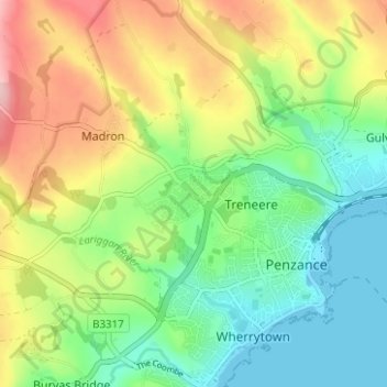
Name: Heamoor topographic map, elevation, terrain.
Location: Heamoor, Penzance, Cornwall, England, TR18 3DZ, United Kingdom (50.10642 -5.57115 50.14642 -5.53115)
Average elevation: 68 m
Minimum elevation: 0 m
Maximum elevation: 178 m
Thank you for supporting this site ❤️
Make a donation
Make a donation
Gear up for your next adventure:
As an Amazon Associate, this site earns from qualifying purchases at no extra cost to you.