Geolocate

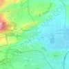
63200 topographic map

Click on the map to display elevation.

About this map

Name: 63200 topographic map, elevation, terrain.

Location: 63200, Riom, Puy-de-Dôme, Auvergne-Rhône-Alpes, France métropolitaine, France (45.84065 3.04174 45.98443 3.20195)

Average elevation: 386 m

Minimum elevation: 307 m

Maximum elevation: 757 m

Other topographic maps

Click on a map to view its topography, its elevation and its terrain.

La Limagne

France > Auvergne-Rhône-Alpes > Puy-de-Dôme > Riom

Average elevation: 328 m

Gear up for your next adventure:

👟Trail Running Shoes - Agile footwear for fast-paced topographic exploration
🔦UV Flashlight - Detect minerals or specific insects in the dark
🧶550 Survival Paracord - Versatile utility cord for emergency repairs and rigging
🏕️Camping Hammock - Integrated protection for sleeping between trees
☕Camping Coffee Maker - Brew fresh coffee anywhere on the topographic map

As an Amazon Associate, this site earns from qualifying purchases at no extra cost to you.