Geolocate

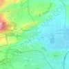
La Limagne topographic map

Click on the map to display elevation.

About this map

Name: La Limagne topographic map, elevation, terrain.

Location: La Limagne, Riom, Puy-de-Dôme, Auvergne-Rhône-Alpes, France métropolitaine, 63200, France (45.90377 3.12859 45.90413 3.12955)

Average elevation: 328 m

Minimum elevation: 314 m

Maximum elevation: 362 m

Other topographic maps

Click on a map to view its topography, its elevation and its terrain.

63200

France > Auvergne-Rhône-Alpes > Puy-de-Dôme > Riom

Average elevation: 386 m

63200

France > Auvergne-Rhône-Alpes > Puy-de-Dôme > Riom

Average elevation: 386 m

Gear up for your next adventure:

🛌Down Sleeping Bag - Superior warmth-to-weight ratio for cold nights
🧼Travel Hand Sanitizer - Keep hands clean when water is scarce
🧥Softshell Hiking Jacket - The perfect balance of wind protection and breathability
🧢Sun Protection Cap - Breathable cap to protect from sun exposure
💡Solar Camping Lamp - Eco-friendly lighting for campsites

As an Amazon Associate, this site earns from qualifying purchases at no extra cost to you.