Geolocate

Moho topographic map

Click on the map to display elevation.

About this map

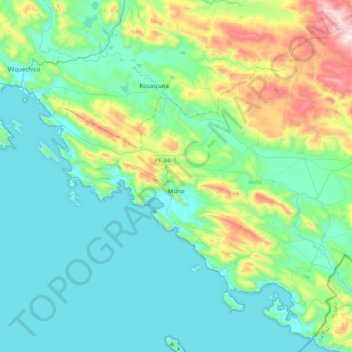
Name: Moho topographic map, elevation, terrain.

Location: Moho, Provincia de Moho, Puno, Perú (-15.47297 -69.66920 -15.21229 -69.23233)

Average elevation: 3,986 m

Minimum elevation: 3,803 m

Maximum elevation: 4,688 m

Other topographic maps

Click on a map to view its topography, its elevation and its terrain.

Ninantaya

Perú > Puno > Moho

Average elevation: 3,928 m

Gear up for your next adventure:

🪜Heavy Duty Carabiners - Multi-use clips for securing gear to your backpack
🧭GPS Handheld Device - Reliable GPS navigation for outdoor adventures
🧤Insulated Winter Gloves - Heavy-duty protection for sub-zero Canadian adventures
🔭Compact Binoculars - Lightweight optics for scouting trails and wildlife
🧥Thermal Fleece Jacket - Versatile insulation for changing mountain temperatures

As an Amazon Associate, this site earns from qualifying purchases at no extra cost to you.