Geolocate

Ninantaya topographic map

Click on the map to display elevation.

About this map

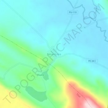
Name: Ninantaya topographic map, elevation, terrain.

Location: Ninantaya, Moho, Puno, Perú (-15.46874 -69.35111 -15.42874 -69.31111)

Average elevation: 3,928 m

Minimum elevation: 3,861 m

Maximum elevation: 4,181 m

Other topographic maps

Click on a map to view its topography, its elevation and its terrain.

Moho

Perú > Puno > Moho

Average elevation: 3,986 m

Gear up for your next adventure:

🥾Light Trekking Boots - Supportive boots for multi-day treks
📷Outdoor Action Camera - Capture high-elevation views and rugged adventures
🧰Multitool Knife - Compact and versatile tool for outdoor use
💡LED Headlamp - Hands-free illumination for night hiking and camping
🎒Hiking Daypack - Lightweight and durable backpacks for day trips and excursions

As an Amazon Associate, this site earns from qualifying purchases at no extra cost to you.