Geolocate

Tagapo topographic map

Click on the map to display elevation.

About this map

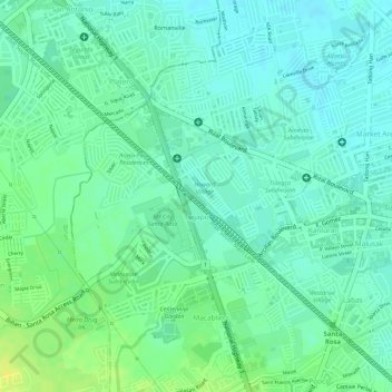
Name: Tagapo topographic map, elevation, terrain.

Location: Tagapo, Santa Rosa, Laguna, Calabarzon, 4026, Philippines (14.30337 121.09120 14.32667 121.11216)

Average elevation: 12 m

Minimum elevation: 3 m

Maximum elevation: 25 m

Other topographic maps

Click on a map to view its topography, its elevation and its terrain.

Santa Rosa

Philippines > Laguna > Santa Rosa

Average elevation: 65 m

Nuvali Lake

Philippines > Laguna > Santa Rosa

Average elevation: 105 m

Aplaya

Philippines > Laguna > Santa Rosa > Aplaya

Average elevation: 5 m

Gear up for your next adventure:

🔋Lithium AA Batteries - Long-lasting power that performs in extreme cold
🥾Waterproof Hiking Boots - Essential footwear for rugged terrain and wet Canadian trails
🧰Survival Kit - Essential gear for emergencies in the wilderness
🩹Compact First Aid Kit - Pre-packed essentials for common trail injuries
🥽Outdoor Goggles - Protective eyewear for outdoor activities

As an Amazon Associate, this site earns from qualifying purchases at no extra cost to you.