
Little Straggle Lake topographic map
Click on the map to display elevation.
About this map
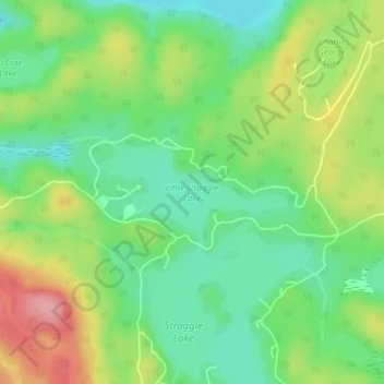
Name: Little Straggle Lake topographic map, elevation, terrain.
Average elevation: 433 m
Minimum elevation: 386 m
Maximum elevation: 506 m
Haliburton County trails, hiking, mountain biking, running and outdoor activities
Other topographic maps
Click on a map to view its topography, its elevation and its terrain.
Fort Irwin Conservation Area Trail Head
Canada > Ontario > Haliburton County > Dysart et al
Average elevation: 391 m