
Donald topographic map
Click on the map to display elevation.
About this map
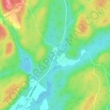
Name: Donald topographic map, elevation, terrain.
Average elevation: 356 m
Minimum elevation: 325 m
Maximum elevation: 403 m
Haliburton County trails, hiking, mountain biking, running and outdoor activities
Other topographic maps
Click on a map to view its topography, its elevation and its terrain.
Green Lake
Canada > Ontario > Haliburton County > Dysart et al > West Guilford
Average elevation: 326 m