
Lac-des-Dix-Milles topographic map
Interactive map
Click on the map to display elevation.
About this map
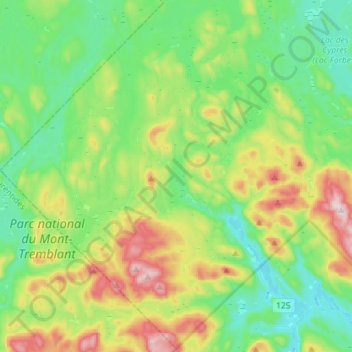
Name: Lac-des-Dix-Milles topographic map, elevation, terrain.
Location: Lac-des-Dix-Milles, Matawinie, Lanaudière, Quebec, Canada (46.35392 -74.47748 46.54785 -74.19162)
Average elevation: 528 m
Minimum elevation: 385 m
Maximum elevation: 871 m
Other topographic maps
Click on a map to view its topography, its elevation and its terrain.
Lac Lajoie
Canada > Quebec > Lac-des-Dix-Milles
Lac Lajoie, Sentier de la Chute-aux-Rats, Lac-des-Dix-Milles, Matawinie, Lanaudière, Quebec, Canada
Average elevation: 486 m