
Ten Boer topographic map
Interactive map
Click on the map to display elevation.
About this map
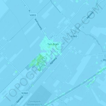
Name: Ten Boer topographic map, elevation, terrain.
Location: Ten Boer, Groningen, Niederlande (53.25282 6.66695 53.29470 6.72248)
Average elevation: -1 m
Minimum elevation: -4 m
Maximum elevation: 4 m
Other topographic maps
Click on a map to view its topography, its elevation and its terrain.
Garmerwolde
Niederlande > Groningen > Groningen
Garmerwolde, Groningen, Niederlande
Average elevation: -1 m