Geolocate

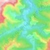
Cassagnas topographic map

Click on the map to display elevation.

About this map

Name: Cassagnas topographic map, elevation, terrain.

Location: Cassagnas, Florac, Lozère, Occitania, Metropolitan France, 48400, France (44.24056 3.67699 44.32027 3.78118)

Average elevation: 977 m

Minimum elevation: 572 m

Maximum elevation: 1,419 m

Other topographic maps

Click on a map to view its topography, its elevation and its terrain.
Sauveplane

France > Occitania > Lozère

Average elevation: 463 m

Les Vanels

France > Occitania > Lozère > Vebron

Average elevation: 813 m

Le Coustat

France > Occitania > Lozère > Nasbinals

Average elevation: 1,202 m

Lespartis

France > Occitania > Lozère > Peyre en Aubrac > Aumont-Aubrac

Average elevation: 1,047 m

Gear up for your next adventure:

🦶Hiking Shoe Insoles - Added support for high arches and long days on feet
🔦LED Flashlight - Powerful and long-lasting flashlight for camping and emergencies
🧢Hiking Hat - Sun-protective and breathable hats for long treks
🔥Emergency Fire Starter - Reliable ignition source for all weather conditions
🧤Thermal Hiking Gloves - Grip-enhanced gloves for cold-weather altitude trekking

As an Amazon Associate, this site earns from qualifying purchases at no extra cost to you.