Geolocate

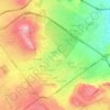
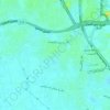
October Hills topographic map

Click on the map to display elevation.

About this map

Name: October Hills topographic map, elevation, terrain.

Location: October Hills, Giza, 12568, Egypt (29.99344 30.95367 30.03344 30.99367)

Average elevation: 158 m

Minimum elevation: 107 m

Maximum elevation: 198 m

Other topographic maps

Click on a map to view its topography, its elevation and its terrain.
Giza Pyramids

Egypt > Giza > Giza

Average elevation: 65 m

Wadi Al-Hitan (Whale Valley)

Egypt > Giza

Average elevation: 97 m

Giza Pyramids

Egypt > Giza > Giza

Average elevation: 65 m

Sheikh Zayed

Egypt > Giza

Average elevation: 122 m

Giza Pyramids

Egypt > Giza > Giza

Average elevation: 65 m

Al Haraneya Village

Egypt > Giza

Average elevation: 19 m

Jazirat Warraq al Hadar

Egypt > Giza > Tanaash

Average elevation: 20 m

Kerdasa City

Egypt > Giza > Kirdasah

Average elevation: 28 m

Abo Al Nomros City

Egypt > Giza > Abu An Numrus

Average elevation: 20 m

Ard Al Lwaa'

Egypt > Giza > Nazlet Bahgat

Average elevation: 23 m

Al Mounib

Egypt > Giza

Average elevation: 22 m

City View

Egypt > Giza

Average elevation: 65 m

Gezirat Dahab

Egypt > Giza

Average elevation: 21 m

Ard Al Lwaa'

Egypt > Giza > Nazlet Bahgat

Average elevation: 23 m

Gear up for your next adventure:

🥾Mountain Hiking Shoes - Shoes with superior grip for mountainous terrain
🚲MTB Frame Bag - Carry tools and maps directly on your bicycle frame
⛺Lightweight Camping Tent - Portable shelter optimized for Canadian backcountry camping
🥾Hiking Boots - Sturdy boots providing ankle support and traction on rugged trails
🥾Waterproof Hiking Shoes - Durable shoes for wet and rugged trails

As an Amazon Associate, this site earns from qualifying purchases at no extra cost to you.