
Laugharne Township Community topographic map
Interactive map
Click on the map to display elevation.
About this map
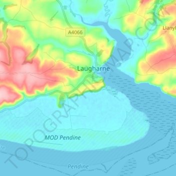
Name: Laugharne Township Community topographic map, elevation, terrain.
Average elevation: 33 m
Minimum elevation: 0 m
Maximum elevation: 156 m
Other topographic maps
Click on a map to view its topography, its elevation and its terrain.
Laugharne
United Kingdom > Wales > Laugharne
Laugharne, Carmarthenshire, Wales, SA33 4SR, United Kingdom
Average elevation: 38 m