Geolocate

Springerville topographic map

Click on the map to display elevation.

Springerville

Springerville sits at an elevation of 6,907 feet (2,105 m) above sea level. Along with its neighbor Eagar, the communities make up the place known as Round Valley, which is in the central-eastern part of Arizona close to the New Mexico border.

Wikipedia (CC-BY-SA 3.0)

About this map

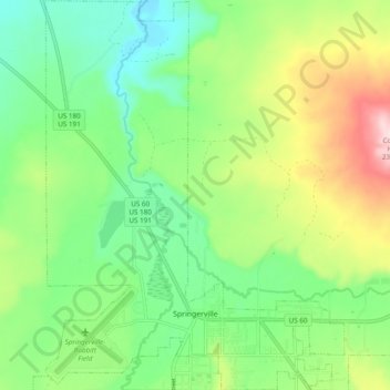
Name: Springerville topographic map, elevation, terrain.

Location: Springerville, Apache County, Arizona, United States (34.11833 -109.32331 34.19819 -109.24908)

Average elevation: 2,150 m

Minimum elevation: 2,041 m

Maximum elevation: 2,356 m

Other topographic maps

Click on a map to view its topography, its elevation and its terrain.

Sanders

United States > Arizona > Apache County

Average elevation: 1,801 m

Fort Defiance

United States > Arizona > Apache County

Average elevation: 2,130 m

East Mesa

United States > Arizona > Apache County

Average elevation: 2,093 m

Spider Rock

United States > Arizona > Apache County

Average elevation: 1,954 m

Concho

United States > Arizona > Apache County

Average elevation: 1,844 m

Greer

United States > Arizona > Apache County

Average elevation: 2,669 m

Lupton

United States > Arizona > Apache County

Average elevation: 1,942 m

Chambers

United States > Arizona > Apache County

Average elevation: 1,776 m

Vernon

United States > Arizona > Apache County

Average elevation: 2,119 m

Many Farms

United States > Arizona > Apache County

Average elevation: 1,641 m

Red Hill

United States > Arizona > Apache County

Average elevation: 1,830 m

Red Rock

United States > Arizona > Apache County

Average elevation: 1,780 m

Sawmill

United States > Arizona > Apache County

Average elevation: 2,354 m

Red Rock

United States > Arizona > Apache County

Average elevation: 1,780 m

Concho

United States > Arizona > Apache County

Average elevation: 1,844 m

Lukachukai

United States > Arizona > Apache County

Average elevation: 2,004 m

Vernon

United States > Arizona > Apache County

Average elevation: 2,119 m

Nutrioso

United States > Arizona > Apache County

Average elevation: 2,404 m

Toyei

United States > Arizona > Apache County

Average elevation: 1,993 m

Chinle

United States > Arizona > Apache County > Chinle

Average elevation: 1,715 m

Michigan Lake

United States > Arizona > Apache County

Average elevation: 1,888 m

St. Michaels

United States > Arizona > Apache County

Average elevation: 2,066 m

Concho

United States > Arizona > Apache County > Concho

Average elevation: 1,844 m

Red Rock

United States > Arizona > Apache County

Average elevation: 1,780 m

Eagle Crag

United States > Arizona > Apache County

Average elevation: 1,970 m

Gear up for your next adventure:

🌡️Emergency Mylar Blankets - Compact thermal protection for unexpected nights outdoors
🔋Lithium AA Batteries - Long-lasting power that performs in extreme cold
🧳Compression Sacks - Maximize space in your backpack by shrinking gear
🎒Hiking Backpack - Lightweight and ergonomic backpacks for day hikes or multi-day treks
🧦Merino Wool Socks - Moisture-wicking comfort for long-distance hiking

As an Amazon Associate, this site earns from qualifying purchases at no extra cost to you.