Geolocate

Greer topographic map

Click on the map to display elevation.

About this map

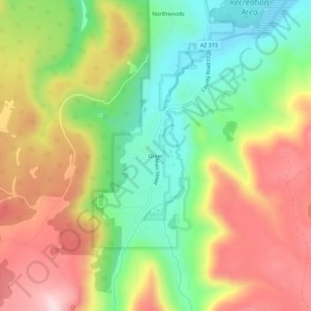
Name: Greer topographic map, elevation, terrain.

Location: Greer, Apache County, Arizona, 85927, United States (33.99005 -109.47870 34.03005 -109.43870)

Average elevation: 2,669 m

Minimum elevation: 2,504 m

Maximum elevation: 2,857 m

Other topographic maps

Click on a map to view its topography, its elevation and its terrain.

Jarvis Lake

United States > Arizona > Apache County

Average elevation: 2,341 m

Reservation Dam

United States > Arizona > Apache County

Average elevation: 2,761 m

Gear up for your next adventure:

🔋Lithium AA Batteries - Long-lasting power that performs in extreme cold
🥾Trail Hiking Socks - Comfortable socks to prevent blisters and fatigue
🥾Mountain Hiking Boots - High-traction boots for rocky terrain
🎒Backpack Rain Cover - External shield to keep your entire pack dry
Camping Groundsheet - Protect your tent from moisture and dirt

As an Amazon Associate, this site earns from qualifying purchases at no extra cost to you.