Geolocate

Ryton Pools Country Park topographic map

Click on the map to display elevation.

About this map

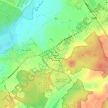
Name: Ryton Pools Country Park topographic map, elevation, terrain.

Location: Ryton Pools Country Park, Ryton on Dunsmore CP, Rugby, Warwickshire, England, CV8 3BG, United Kingdom (52.34450 -1.46249 52.35347 -1.44786)

Average elevation: 82 m

Minimum elevation: 58 m

Maximum elevation: 107 m

Other topographic maps

Click on a map to view its topography, its elevation and its terrain.

Grandborough CP

United Kingdom > England > Warwickshire > Rugby

Average elevation: 92 m

Cawston

United Kingdom > England > Warwickshire > Rugby

Average elevation: 109 m

Birdingbury CP

United Kingdom > England > Warwickshire > Rugby

Average elevation: 82 m

Long Lawford

United Kingdom > England > Warwickshire > Rugby

Average elevation: 101 m

Dunchurch

United Kingdom > England > Warwickshire > Rugby

Average elevation: 102 m

Thurlaston CP

United Kingdom > England > Warwickshire > Rugby

Average elevation: 98 m

Newton

United Kingdom > England > Warwickshire > Rugby

Average elevation: 114 m

Pailton CP

United Kingdom > England > Warwickshire > Rugby

Average elevation: 117 m

Ansty CP

United Kingdom > England > Warwickshire > Rugby

Average elevation: 91 m

Churchover CP

United Kingdom > England > Warwickshire > Rugby

Average elevation: 115 m

Brinklow CP

United Kingdom > England > Warwickshire > Rugby

Average elevation: 90 m

Binley Woods CP

United Kingdom > England > Warwickshire > Rugby

Average elevation: 86 m

Withybrook CP

United Kingdom > England > Warwickshire > Rugby

Average elevation: 115 m

Wolvey CP

United Kingdom > England > Warwickshire > Rugby

Average elevation: 113 m

Newbold on Avon

United Kingdom > England > Warwickshire > Rugby

Average elevation: 98 m

Bilton

United Kingdom > England > Warwickshire > Rugby

Average elevation: 111 m

Draycote

United Kingdom > England > Warwickshire > Rugby

Average elevation: 94 m

Newton

United Kingdom > England > Warwickshire > Rugby

Average elevation: 114 m

Bramcote

United Kingdom > England > Warwickshire > Rugby

Average elevation: 105 m

Dunchurch

United Kingdom > England > Warwickshire > Rugby

Average elevation: 102 m

Barnacle

United Kingdom > England > Warwickshire > Rugby > Barnacle

Average elevation: 102 m

Frankton CP

United Kingdom > England > Warwickshire > Rugby > Frankton CP

Average elevation: 95 m

Wibtoft CP

United Kingdom > England > Warwickshire > Rugby > Wibtoft CP

Average elevation: 124 m

Thurlaston CP

United Kingdom > England > Warwickshire > Rugby

Average elevation: 98 m

Monks Kirby CP

United Kingdom > England > Warwickshire > Rugby

Average elevation: 117 m

Churchover CP

United Kingdom > England > Warwickshire > Rugby

Average elevation: 115 m

Gear up for your next adventure:

💡Solar Camping Lamp - Eco-friendly lighting for campsites
🧴Outdoor Sunscreen - High SPF protection for high-altitude UV exposure
🪑Ultralight Camping Stool - Compact seating for rest stops during long hikes
🧊Insulated Water Bottle - Keeps drinks cold in summer and prevents freezing in winter
🥾Approach Boots - Comfortable boots for hiking and climbing approaches

As an Amazon Associate, this site earns from qualifying purchases at no extra cost to you.