Geolocate

Gardnerville topographic map

Click on the map to display elevation.

About this map
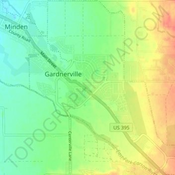
Name: Gardnerville topographic map, elevation, terrain.

Location: Gardnerville, Douglas County, Nevada, United States (38.91424 -119.76135 38.96131 -119.70264)

Average elevation: 1,457 m

Minimum elevation: 1,436 m

Maximum elevation: 1,485 m

Gear up for your next adventure:

🥾Hiking Leggings - Comfortable leggings for outdoor activities
🏃Hydration Running Vest - Carry water and maps close to your body for speed
🚲Handlebar Phone Mount - View topographic-map.com live while cycling
🧥Insulated Jacket - Keep warm in cold outdoor conditions
🧰Survival Kit - Essential gear for emergencies in the wilderness

As an Amazon Associate, this site earns from qualifying purchases at no extra cost to you.