Geolocate

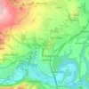
Pontcysyllte topographic map

Click on the map to display elevation.

About this map

Name: Pontcysyllte topographic map, elevation, terrain.

Location: Pontcysyllte, Wrexham, Wales, LL20 7YS, United Kingdom (52.95137 -3.10973 52.99137 -3.06973)

Average elevation: 160 m

Minimum elevation: 52 m

Maximum elevation: 392 m

Other topographic maps

Click on a map to view its topography, its elevation and its terrain.
Bangor-on-Dee

United Kingdom > Wales > Wrexham

Average elevation: 30 m

Cefn

United Kingdom > Wales > Wrexham > Acrefair

Average elevation: 142 m

Gwersyllt

United Kingdom > Wales > Wrexham

Average elevation: 112 m

Penycae

United Kingdom > Wales > Wrexham

Average elevation: 350 m

Rhosddu

United Kingdom > Wales > Wrexham

Average elevation: 88 m

Ceiriog Ucha

United Kingdom > Wales > Wrexham

Average elevation: 420 m

Gear up for your next adventure:

🛏️Sleeping Bag - Warm and compact sleeping bags for outdoor camping
🧰Multitool Knife - Compact and versatile tool for outdoor use
🥾Trail Running Boots - Durable shoes designed for trail running
🧭GPS Outdoor Watch - Smart watch for navigation and fitness tracking in nature
📷Outdoor Action Camera - Capture high-elevation views and rugged adventures

As an Amazon Associate, this site earns from qualifying purchases at no extra cost to you.