Geolocate

Pijnacker topographic map

Click on the map to display elevation.

About this map
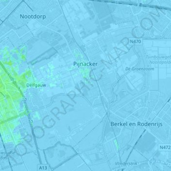
Name: Pijnacker topographic map, elevation, terrain.

Location: Pijnacker, Pijnacker-Nootdorp, South Holland, Netherlands (51.96820 4.40165 52.05028 4.47679)

Average elevation: -2 m

Minimum elevation: -8 m

Maximum elevation: 5 m

Other topographic maps

Click on a map to view its topography, its elevation and its terrain.

Tweede Tol

Netherlands > South Holland > Dordrecht

Average elevation: 0 m

Gooland

Netherlands > South Holland > Nootdorp

Average elevation: -2 m

Langeraar

Netherlands > South Holland

Average elevation: -3 m

Waalhaven

Netherlands > South Holland > Rotterdam

Average elevation: 3 m

Meijendel

Netherlands > South Holland > Wassenaar

Average elevation: 6 m

Meije

Netherlands > South Holland > Nieuwkoop

Average elevation: -2 m

Ankerpark

Netherlands > South Holland > Leiden

Average elevation: 3 m

Botlek

Netherlands > South Holland

Average elevation: 3 m

Weerestein

Netherlands > South Holland > Hillegom

Average elevation: 0 m

Weerestein

Netherlands > South Holland > Hillegom

Average elevation: 0 m

Coepelduynen

Netherlands > South Holland > Katwijk

Average elevation: 4 m

Middelsluis

Netherlands > South Holland > Numansdorp

Average elevation: 0 m

Broekhuizen

Netherlands > South Holland > Gouda

Average elevation: -1 m

Het Park

Netherlands > South Holland > Rotterdam

Average elevation: 4 m

Gear up for your next adventure:

🧭GPS Handheld Device - Reliable GPS navigation for outdoor adventures
👟Sport Hiking Sandals - Breathable footwear for water crossings and camp rest
🧥Waterproof Hiking Jacket - Protect yourself from rain and wind while hiking
🥾Mountain Hiking Boots - High-traction boots for rocky terrain
⛺Tent Footprint - Protect tent floor and increase durability

As an Amazon Associate, this site earns from qualifying purchases at no extra cost to you.