Geolocate

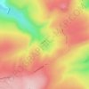
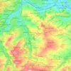
Birkenshaw topographic map

Click on the map to display elevation.

About this map

Name: Birkenshaw topographic map, elevation, terrain.

Location: Birkenshaw, Kirklees, West Yorkshire, England, BD11 2HY, United Kingdom (53.73273 -1.71336 53.77273 -1.67336)

Average elevation: 163 m

Minimum elevation: 83 m

Maximum elevation: 224 m

Other topographic maps

Click on a map to view its topography, its elevation and its terrain.
Meltham

United Kingdom > England > Kirklees

Average elevation: 278 m

Holme Valley

United Kingdom > England > Kirklees > Holmfirth

Average elevation: 290 m

Holmfirth Branch

United Kingdom > England > Kirklees > Brockholes

Average elevation: 185 m

Mirfield

United Kingdom > England > Kirklees > Lower Hopton

Average elevation: 97 m

Denby Dale

United Kingdom > England > Kirklees > Scissett

Average elevation: 168 m

Kirkburton

United Kingdom > England > Kirklees

Average elevation: 148 m

Greenhead Park

United Kingdom > England > Kirklees > Huddersfield

Average elevation: 119 m

Hey Wood

United Kingdom > England > Kirklees > Farnley Tyas

Average elevation: 186 m

Crow Nest Park

United Kingdom > England > Kirklees > Dewsbury

Average elevation: 64 m

Denby Dale

United Kingdom > England > Kirklees

Average elevation: 187 m

Gear up for your next adventure:

🚲Heavy Duty Bike Lock - Secure your bike at the trailhead or during stops
🔪Outdoor Multitool - Versatile tool for repairs and food prep in the wild
⛺Camping Essentials - All-in-one gear for a comfortable camping trip
🚑Survival Whistle - Signal for help across long distances in mountains
🧰Emergency Multi-Tool - Compact multi-tool for outdoor survival

As an Amazon Associate, this site earns from qualifying purchases at no extra cost to you.