Geolocate

Ferozepur topographic map

Click on the map to display elevation.

About this map
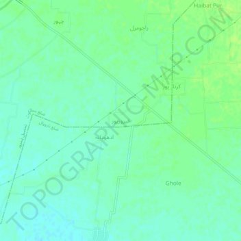
Name: Ferozepur topographic map, elevation, terrain.

Location: Ferozepur, Pasrur Tehsil, Sialkot District, Gujranwala Division, Punjab, Pakistan (32.28571 74.82302 32.32571 74.86302)

Average elevation: 260 m

Minimum elevation: 254 m

Maximum elevation: 265 m

Other topographic maps

Click on a map to view its topography, its elevation and its terrain.
Daska

Pakistan > Punjab > Siālkot District

Average elevation: 236 m

Gear up for your next adventure:

🥾Approach Boots - Comfortable boots for hiking and climbing approaches
💧Reusable Water Bottle - Durable water bottles for hydration on trails
🧴Waterproofing Spray - Restore the DWR coating on jackets and tents
🥾Approach Shoes - Shoes designed for climbing approaches and rugged trails
⛺Family Camping Tent - Spacious tent suitable for family camping trips

As an Amazon Associate, this site earns from qualifying purchases at no extra cost to you.