
Uttarkashi topographic map
Interactive map
Click on the map to display elevation.
About this map
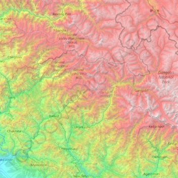
Name: Uttarkashi topographic map, elevation, terrain.
Location: Uttarkashi, Uttarakhand, India (30.36000 77.86000 31.64000 79.14000)
Average elevation: 3,290 m
Minimum elevation: 441 m
Maximum elevation: 6,928 m
Other topographic maps
Click on a map to view its topography, its elevation and its terrain.
Lachi
India > Uttarakhand > Thailisain > Matkunda > Lachi
Lachi, Matkunda, Thailisain, Pauri Garhwal, Uttarakhand, 246278, India
Average elevation: 1,507 m
Rajaji National Park
India > Uttarakhand > Totla
Rajaji National Park, Laxman Jhula, Pandav Gufa, Totla, Pauri Garhwal, Uttarakhand, 249304, India
Average elevation: 709 m