Geolocate

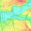
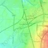
Hutton topographic map

Click on the map to display elevation.

About this map

Name: Hutton topographic map, elevation, terrain.

Location: Hutton, New Longton, South Ribble, Lancashire, England, United Kingdom (53.72544 -2.85388 53.75430 -2.71695)

Average elevation: 17 m

Minimum elevation: 0 m

Maximum elevation: 44 m

Other topographic maps

Click on a map to view its topography, its elevation and its terrain.
Leyland

United Kingdom > England > Lancashire > South Ribble

Average elevation: 41 m

New Gate

United Kingdom > England > Lancashire > South Ribble

Average elevation: 28 m

Gear up for your next adventure:

🔋Solar Power Bank - Keep your GPS and devices charged during long outdoor trips
🔨Vehicle Emergency Tool - Safety tool for remote road trips to trailheads
🥾Waterproof Hiking Shoes - Durable shoes for wet and rugged trails
💡Solar Camping Lamp - Eco-friendly lighting for campsites
💡Portable Camping Lamp - Rechargeable lamp for campsite lighting

As an Amazon Associate, this site earns from qualifying purchases at no extra cost to you.