
Lindford topographic map
Interactive map
Click on the map to display elevation.
About this map
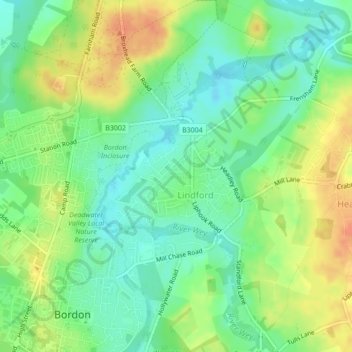
Name: Lindford topographic map, elevation, terrain.
Location: Lindford, East Hampshire, Hampshire, England, United Kingdom (51.11510 -0.85674 51.12425 -0.83847)
Average elevation: 83 m
Minimum elevation: 65 m
Maximum elevation: 105 m