Geolocate

Felpham topographic map

Click on the map to display elevation.

About this map

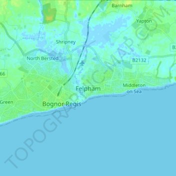
Name: Felpham topographic map, elevation, terrain.

Location: Felpham, Arun, West Sussex, England, PO22 7PA, United Kingdom (50.75046 -0.69412 50.83046 -0.61412)

Average elevation: 2 m

Minimum elevation: -4 m

Maximum elevation: 13 m

Other topographic maps

Click on a map to view its topography, its elevation and its terrain.

East Preston

United Kingdom > England > West Sussex > Arun

Average elevation: 5 m

Gear up for your next adventure:

🧢Outdoor Cap - Protective cap for sun and rain during hikes
🛌Down Sleeping Bag - Superior warmth-to-weight ratio for cold nights
🥾Trekking Boots - Durable boots for long-distance trekking
🚑Survival Whistle - Signal for help across long distances in mountains
🥾Waterproof Trail Shoes - Shoes designed to handle wet terrain

As an Amazon Associate, this site earns from qualifying purchases at no extra cost to you.