Geolocate

East Preston topographic map

Click on the map to display elevation.

About this map

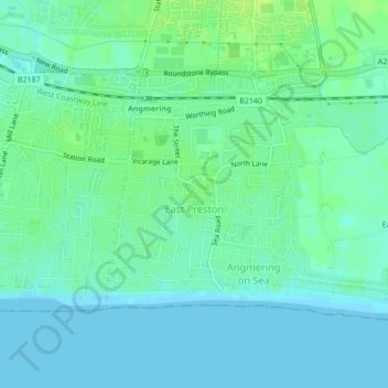
Name: East Preston topographic map, elevation, terrain.

Location: East Preston, Arun, West Sussex, England, United Kingdom (50.80186 -0.49288 50.81775 -0.46928)

Average elevation: 5 m

Minimum elevation: 0 m

Maximum elevation: 13 m

Other topographic maps

Click on a map to view its topography, its elevation and its terrain.

Felpham

United Kingdom > England > West Sussex > Arun

Average elevation: 2 m

Gear up for your next adventure:

🧥Fleece Jacket - Warm and lightweight jacket for layering
🥘Camping Cookware Set - Compact nesting pots and pans for trail cooking
🧴Insect Repellent - Protect yourself from bugs during outdoor adventures
💡LED Headlamp - Hands-free illumination for night hiking and camping
🧭Orienteering Kit - Tools for map reading and navigation in the wild

As an Amazon Associate, this site earns from qualifying purchases at no extra cost to you.