Geolocate

Tingrith topographic map

Click on the map to display elevation.

About this map

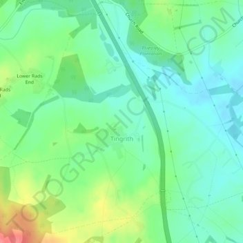
Name: Tingrith topographic map, elevation, terrain.

Location: Tingrith, Central Bedfordshire, England, United Kingdom (51.96963 -0.56520 51.99460 -0.52612)

Average elevation: 94 m

Minimum elevation: 72 m

Maximum elevation: 141 m

Gear up for your next adventure:

🚲Handlebar Phone Mount - View topographic-map.com live while cycling
👖Convertible Hiking Pants - Zip-off legs to adapt to changing weather conditions
🥾Trail Hiking Boots - Supportive boots for rough trails
🪑Ultralight Camping Stool - Compact seating for rest stops during long hikes
🧢Hiking Sun Hat - Wide-brimmed protection for exposed mountain ridges

As an Amazon Associate, this site earns from qualifying purchases at no extra cost to you.